| population | 2,643 peoples |
|---|---|
| area | 156.19 km² |
| population density | 16.9 peoples/km² |
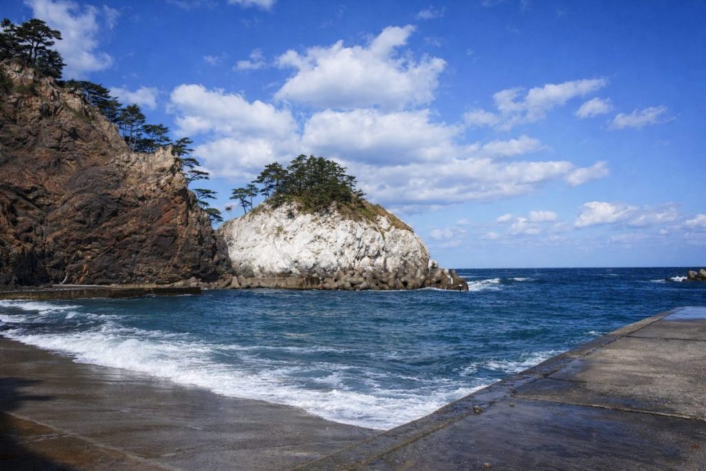
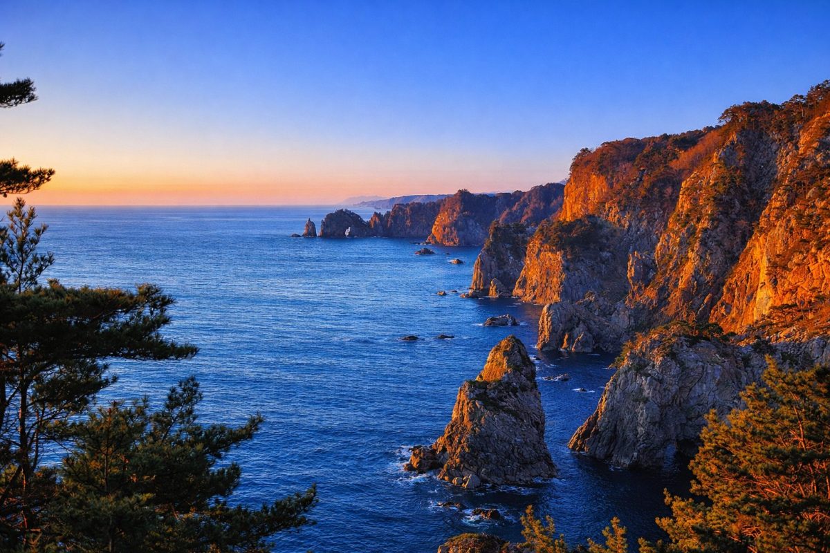
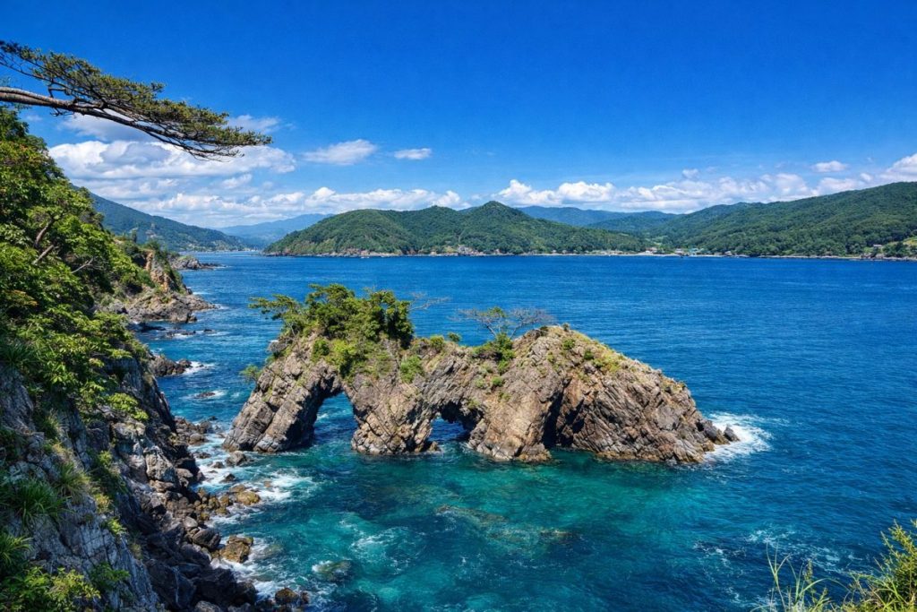
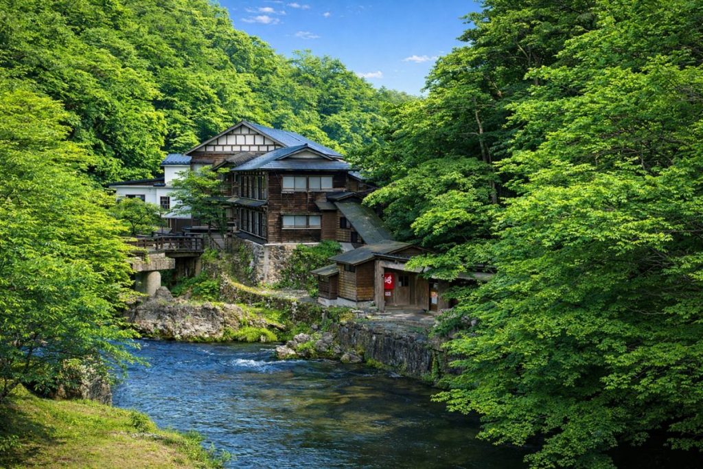
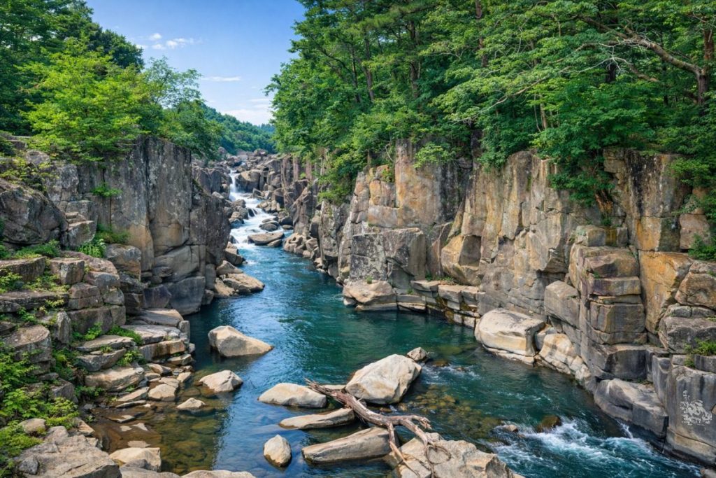
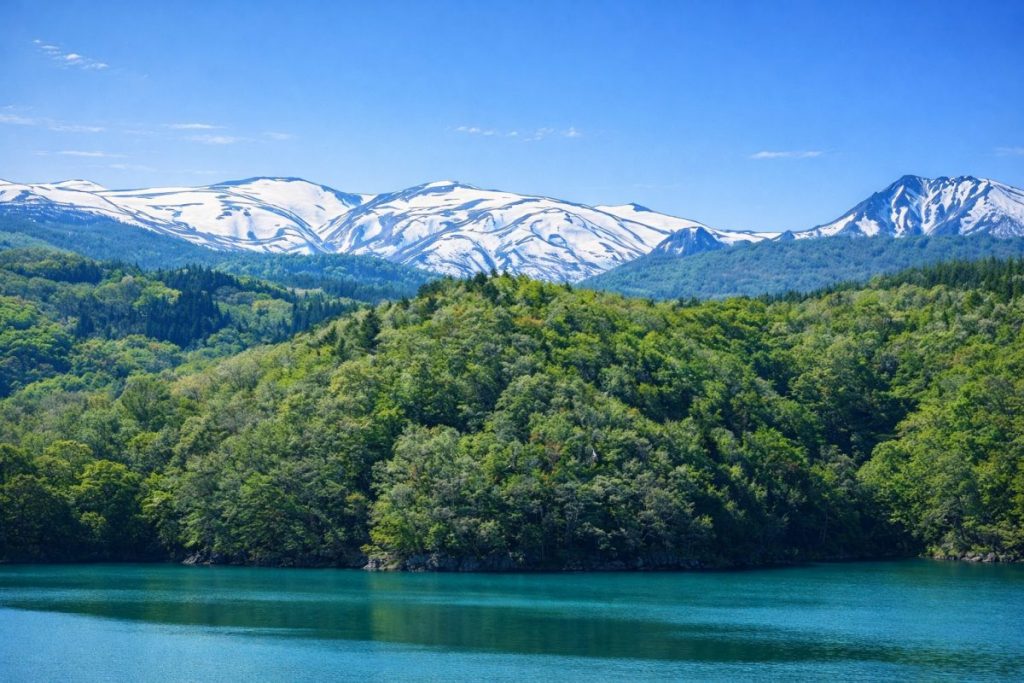
Tanohata Village is located in the northern coastal area of Iwate Prefecture and belongs to Shimohei District. Facing the Pacific Ocean to the east, the village borders Fudai Village to the north and Iwaizumi Town to the west and south. The entire coastline of Tanohata Village is designated as part of Sanriku Fukko National Park, and the area is known for its dramatic ria coastline, including steep cliffs such as Kitayamazaki and Unosu Cliffs. Inland areas consist of gentle mountains and valleys, creating a landscape where the sea and mountains exist in close proximity.
Tanohata Village has long sustained itself through a combination of coastal fisheries, agriculture, forestry, and dairy farming. Even today, primary industries such as fishing for sea urchin, abalone, and seaweed, as well as dairy production, form the backbone of the local economy. While preserving its rich natural environment, the village continues to advance reconstruction and sustainable community development following the Great East Japan Earthquake.
History
The history of Tanohata Village is deeply intertwined with the natural environment of the Sanriku coast. During the early modern period, the area was under the control of the Nanbu Domain, and residents developed livelihoods based on coastal fishing and inland agriculture and forestry. The village has repeatedly suffered damage from major tsunamis, including the Meiji Sanriku Tsunami of 1896 and the Showa Sanriku Tsunami of 1933. These disasters profoundly influenced settlement patterns and daily life, fostering a culture of coexistence with natural hazards.
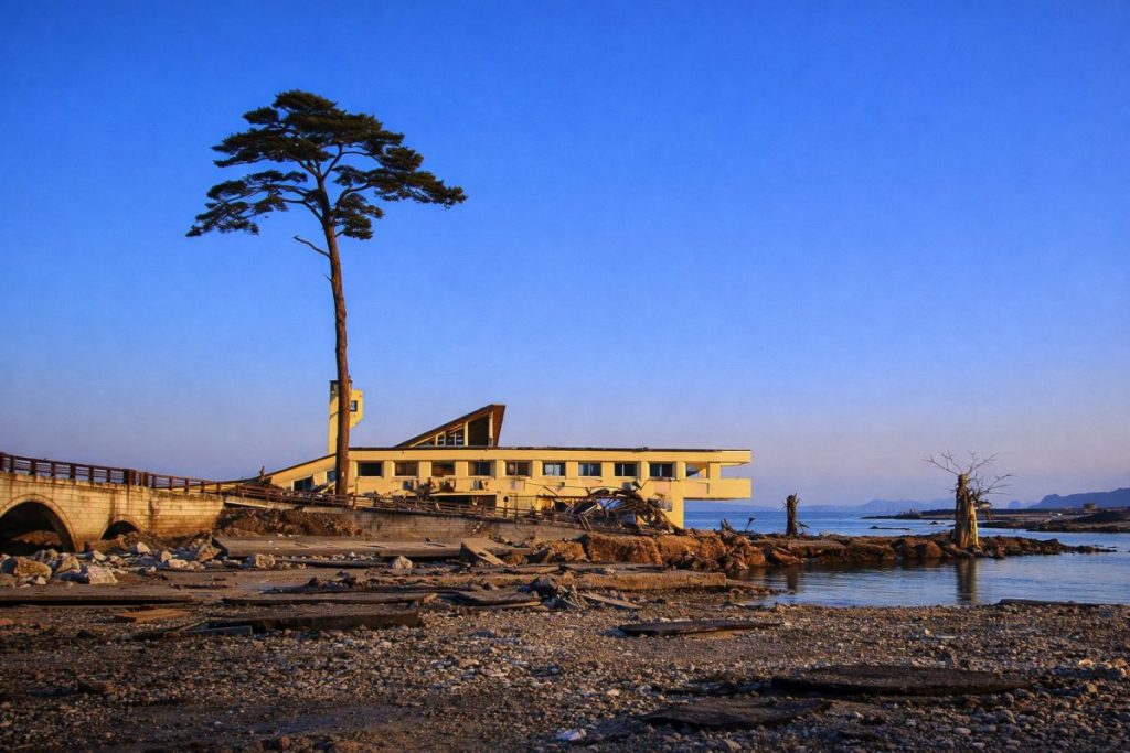
Tanohata Village was officially established in 1889 following the implementation of the municipal system, and in 1897 it became part of Shimohei District after administrative reorganization. In 2011, although seismic intensity was relatively moderate, the tsunami caused by the Great East Japan Earthquake devastated coastal areas such as Shimanokoshi District. Since then, large-scale reconstruction projects, including residential relocation to higher ground and infrastructure redevelopment, have been carried out with a strong emphasis on disaster prevention.
Culture and Traditions
Tanohata Village has nurtured distinctive folk traditions shaped by its coastal and mountainous environment. One of the most notable cultural assets is the Sugakubo Shishiodori (Deer Dance) and Kenbai Sword Dance, designated as an intangible folk cultural property of Iwate Prefecture. These ritual performances have been passed down for generations as offerings to local shrines and are characterized by the rare practice of the same performers presenting both deer dance and sword dance.
Another important cultural feature is the Tsukuehama Banya Group, a collection of traditional fishermen’s huts that convey the historical lifestyle of coastal fishing communities. Recognized as one of the “One Hundred Historical and Cultural Fishing Village Assets to Be Preserved for the Future,” these structures represent the enduring relationship between residents and the sea, as well as the transmission of disaster memories through everyday culture.
Local Specialties
-
Sea Urchin and Abalone:
Harvested from the clean coastal waters of the Sanriku region, Tanohata’s sea urchin and abalone are highly valued for their quality. Strictly managed fishing seasons help maintain sustainable resources.
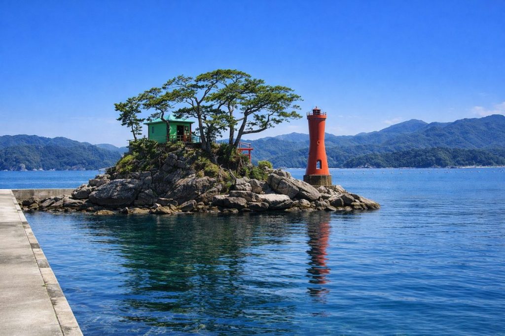
View fishing ports in Tanohata Village -
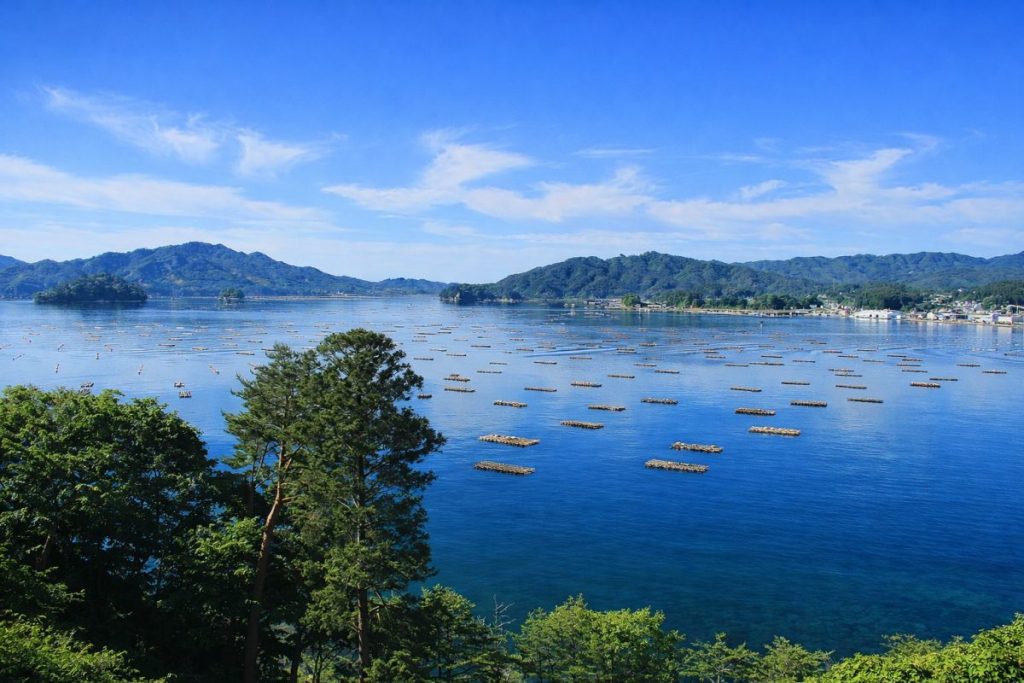
Wakame and Kelp:
Cultivated in cold, nutrient-rich waters influenced by the Oyashio Current, these seaweeds are known for their thickness and rich flavor and are widely distributed for both household and commercial use.
View aquaculture areas -
Dairy Products:
Inland areas support dairy farming, producing milk, yogurt, and ice cream. Small-scale production emphasizes quality and the use of local natural resources.
View dairy farming areas -
Wild Grape Products:
Locally harvested wild grapes are processed into juices and specialty products, reflecting efforts to utilize regional natural resources.
View wild grape areas
Living and Relocation Information
- Daily Convenience: Administrative offices and essential shops are concentrated around the village center, providing basic services for residents.
- Child-Rearing Environment: The village operates its own elementary and junior high schools, offering small-class education and close teacher-student relationships.
- Medical Services: Local clinics are complemented by cooperation with medical institutions in neighboring municipalities.
- Housing: Residential areas developed after the earthquake emphasize safety through relocation to higher ground.
- Lifestyle Features: Residents enjoy a lifestyle closely connected to nature, experiencing pronounced seasonal changes.
Climate and Living Environment
- Pacific coastal climate with cool summers and relatively mild winters.
- Occasional influence of sea fog and cold easterly winds.
- Climate differences between coastal and inland areas.
- Disaster preparedness is deeply integrated into everyday life.
Regional Characteristics (By Area)
-
Shimanokoshi Area: Home to a Sanriku Railway station and a district extensively redeveloped after the tsunami.
Shimanokoshi Station -
Raga Area: A coastal settlement known for tsunami stones that preserve historical tsunami records.
Raga Area -
Tsukue Area: A historic fishing village featuring preserved banya huts.
Tsukuehama Banya Group
Access
- Railway: Sanriku Railway Rias Line: Tanohata Station, Shimanokoshi Station
- Roads: Sanriku Coastal Road
- Bus: Tanohata Village-operated buses provide local transportation.
Tourist Attractions
- Kitayamazaki — A dramatic cliff formation overlooking the Pacific Ocean.
- Unosu Cliffs — Powerful coastal cliffs shaped by marine erosion.
- Tsukuehama Banya Group — Historic fishermen’s huts preserving traditional coastal culture.
Related Links
Iwate Major Cities
This section presents a list of major cities in Iwate Prefecture.
You can access the hub page that consolidates information on Iwate Prefecture’s major cities via the button below.
-

Which Prefecture Is Ninohe City In? [Answer] Iwate Prefecture | Complete Guide to Ninohe City (Sightseeing, Culture, Local Products & Access)
-
Which Prefecture Is Kuji City In? [Answer] Iwate Prefecture | Complete Guide to Kuji City (Sightseeing, Culture, Local Products & Access)
-
Which Prefecture Is Ofunato City In? [Answer] Iwate Prefecture | Complete Guide to Ofunato City (Sightseeing, Culture, Local Products & Access)
-
Which Prefecture Is Miyako City In? [Answer] Iwate Prefecture | Complete Guide to Miyako City (Sightseeing, Culture, Local Products & Access)
-
Which Prefecture Is Kamaishi City In? [Answer] Iwate Prefecture | Complete Guide to Kamaishi City (Sightseeing, Culture, Local Products & Access)
-
Which Prefecture Is Kitakami City In? [Answer] Iwate Prefecture | Complete Guide to Kitakami City (Sightseeing, Culture, Local Products & Access)
-
Which Prefecture Is Hanamaki City In? [Answer] Iwate Prefecture | Complete Guide to Hanamaki City (Sightseeing, Culture, Local Products & Access)
-
Which Prefecture Is Ichinoseki City In? [Answer] Iwate Prefecture | Complete Guide to Ichinoseki City (Sightseeing, Culture, Local Products & Access)
-
Which Prefecture Is Oshu City In? [Answer] Iwate Prefecture | Complete Guide to Oshu City (Sightseeing, Culture, Local Products & Access)
-
Which Prefecture Is Morioka City In? [Answer] Iwate Prefecture | Complete Guide to Morioka City (Sightseeing, Culture, Local Products & Access)
Coastal Regional Development Bureau
This section presents the municipalities within the Coastal Regional Development Bureau area of Iwate Prefecture.
You can access the hub page that consolidates information on these municipalities via the button below.
-
Which Prefecture Is Fudai Village In? [Answer] Iwate Prefecture | Complete Guide to Fudai Village (Sightseeing, Culture, Local Products & Access)
-
Which Prefecture Is Tanohata Village In? [Answer] Iwate Prefecture | Complete Guide to Tanohata Village (Sightseeing, Culture, Local Products & Access)
-
Which Prefecture Is Iwaizumi Town In? [Answer] Iwate Prefecture | Complete Guide to Iwaizumi Town (Sightseeing, Culture, Local Products & Access)
-
Which Prefecture Is Yamada Town In? [Answer] Iwate Prefecture | Complete Guide to Yamada Town (Sightseeing, Culture, Local Products & Access)
-
Which Prefecture Is Otsuchi Town In? [Answer] Iwate Prefecture | Complete Guide to Otsuchi Town (Sightseeing, Culture, Local Products & Access)
-
Which Prefecture Is Rikuzentakata City In? [Answer] Iwate Prefecture | Complete Guide to Rikuzentakata City (Sightseeing, Culture, Local Products & Access)
-
Which Prefecture Is Ofunato City In? [Answer] Iwate Prefecture | Complete Guide to Ofunato City (Sightseeing, Culture, Local Products & Access)
-
Which Prefecture Is Miyako City In? [Answer] Iwate Prefecture | Complete Guide to Miyako City (Sightseeing, Culture, Local Products & Access)
-
Which Prefecture Is Kamaishi City In? [Answer] Iwate Prefecture | Complete Guide to Kamaishi City (Sightseeing, Culture, Local Products & Access)