| population | 44,104 peoples |
|---|---|
| area | 1,259.18 km² |
| population density | 35 peoples/km² |
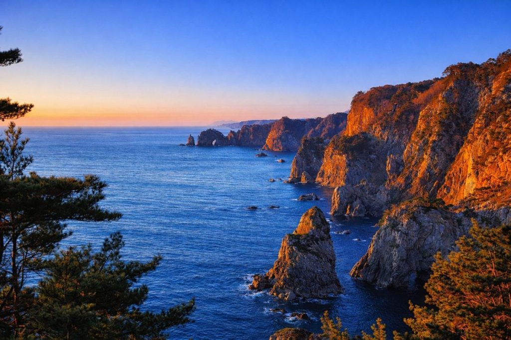
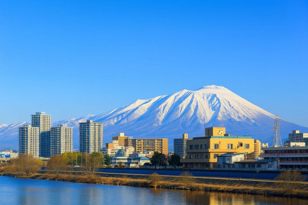
Miyako City is located along the central Sanriku Coast on the Pacific side of Iwate Prefecture, and is one of the region’s key coastal municipalities. The city faces the Pacific Ocean and extends inland into the Kitakami Mountains, encompassing Cape Todogasaki on the Omoto Peninsula, which marks the easternmost point of Honshu. Supported by the rich fishing grounds of the Sanriku offshore area—one of the world’s leading fishing zones—Miyako has long developed as a center of fisheries and maritime transport.
The city was officially established in 1941 and later expanded through the merger with the former towns of Taro and Niisato in 2005, followed by the incorporation of the former Kawai Village in 2010. As a result, Miyako now has the largest municipal land area in Iwate Prefecture. The urban center spreads around the mouth of the Hei River, while the city as a whole consists of coastal settlements, mountainous inland areas, and the rugged peninsula region. Shaped by repeated tsunami disasters, Miyako continues to pursue community development that emphasizes disaster preparedness, coexistence with nature, and sustainable regional growth.
History
Miyako’s historical development was strongly influenced by its role as the outer port of the Morioka Domain during the Edo period. The city prospered as a key maritime hub linking the Sanriku Coast with Edo, where marine products and regional goods were gathered and shipped. In the early Meiji era, Miyako became the site of the Battle of Miyako Bay, an event of significance in Japan’s modern history.
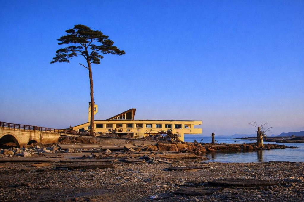
During the Showa period, the opening of the Yamada Line railway, port modernization, and the establishment of mining and manufacturing industries accelerated Miyako’s transformation into a modern port city. At the same time, the city has endured repeated tsunami disasters, including the Meiji Sanriku Earthquake (1896), the Showa Sanriku Earthquake (1933), and the Great East Japan Earthquake of 2011. The 2011 tsunami caused devastating damage to coastal communities, but large-scale reconstruction projects reinforced local solidarity and disaster awareness. Today, Miyako City continues to pass down these historical lessons while striving for resilient and sustainable urban development.
Culture and Traditions
The culture of Miyako City is deeply rooted in its surrounding seas and mountains. Coastal areas have preserved fishing-based lifestyles, while inland districts retain strong mountain village traditions. One of the city’s most distinctive cultural assets is Kuromori Kagura, a traditional performing art designated as an Important Intangible Folk Cultural Property of Japan. Performed mainly during the New Year season, it involves ritual visits to households across wide areas, reflecting a unique spiritual heritage.
In addition, numerous tsunami monuments and disaster relics remain throughout the city, serving as reminders of past catastrophes and as educational resources for disaster prevention. These cultural landscapes are not merely historical remains but are actively used in community education and tourism. Miyako values the coexistence of traditional culture and contemporary civic activities, emphasizing the inheritance of local identity shaped by nature and history.
Local Products
-
Fresh Seafood from Miyako:
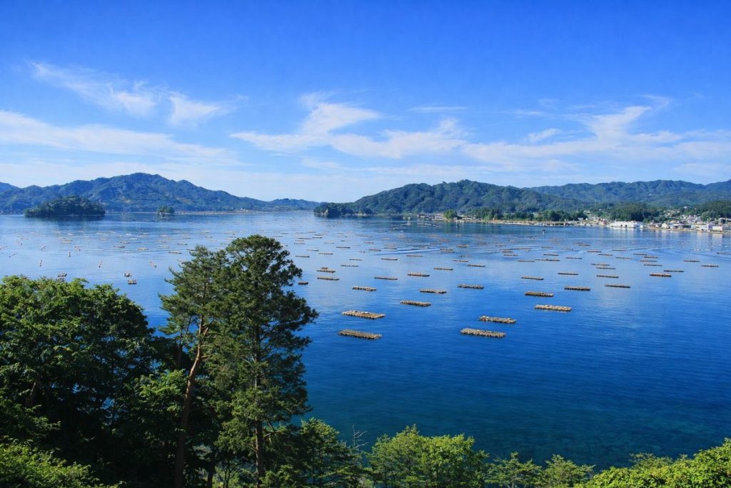
Supported by the Sanriku fishing grounds, Miyako lands a wide variety of fish such as Pacific saury, salmon, cod, walleye pollock, and squid. Fisheries and seafood processing industries are concentrated around Miyako Port, supplying products nationwide.
Miyako Fish Market -
Bin-don:
A local specialty dish featuring sea urchin, salmon roe, and other seafood served from a bottle-shaped container over rice. Developed after the 2011 disaster as part of tourism promotion, Bin-don has become a signature gourmet attraction of Miyako.
Roadside Station Miyako -
Wakame and Kelp:
The coastal waters around the Omoto Peninsula are renowned for high-quality seaweed production. Thick and flavorful wakame and kelp are harvested and widely distributed for both household and commercial use.
Omoe Fishing Port
Living and Relocation Information
- Daily Convenience:Medical facilities, commercial centers, and administrative offices are concentrated around Miyako Station and the city center, allowing residents to meet most daily needs locally.
- Child-Rearing Environment:The city maintains a network of childcare centers, elementary and secondary schools, and high schools, with an emphasis on nature-based learning and disaster education.
- Medical Care:In addition to local hospitals and clinics, Miyako is well connected to advanced medical institutions in Morioka City. Official information is available on the Miyako City website.
- Housing:Residential options range from urban neighborhoods to coastal villages and rural mountain areas. Programs for vacant house utilization and migration support are also in place.
- Lifestyle Characteristics:While snowfall occurs in winter, coastal areas experience relatively mild conditions, enabling a comfortable lifestyle with clear seasonal changes.
Climate and Living Environment
- Pacific coastal climate with cool summers and relatively mild winters.
- Greater temperature variation and heavier snowfall in inland and mountainous areas.
- A living environment closely connected to the sea, rivers, and mountains.
- Well-developed disaster prevention infrastructure, including tsunami countermeasures.
Regional Characteristics (by Area)
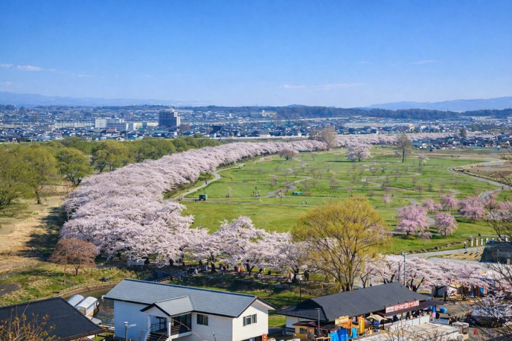
- Miyako Area:The administrative and commercial center of the city, centered around Miyako Station.
-
Taro Area:A coastal district known for its massive tsunami seawalls and long history of disaster prevention.
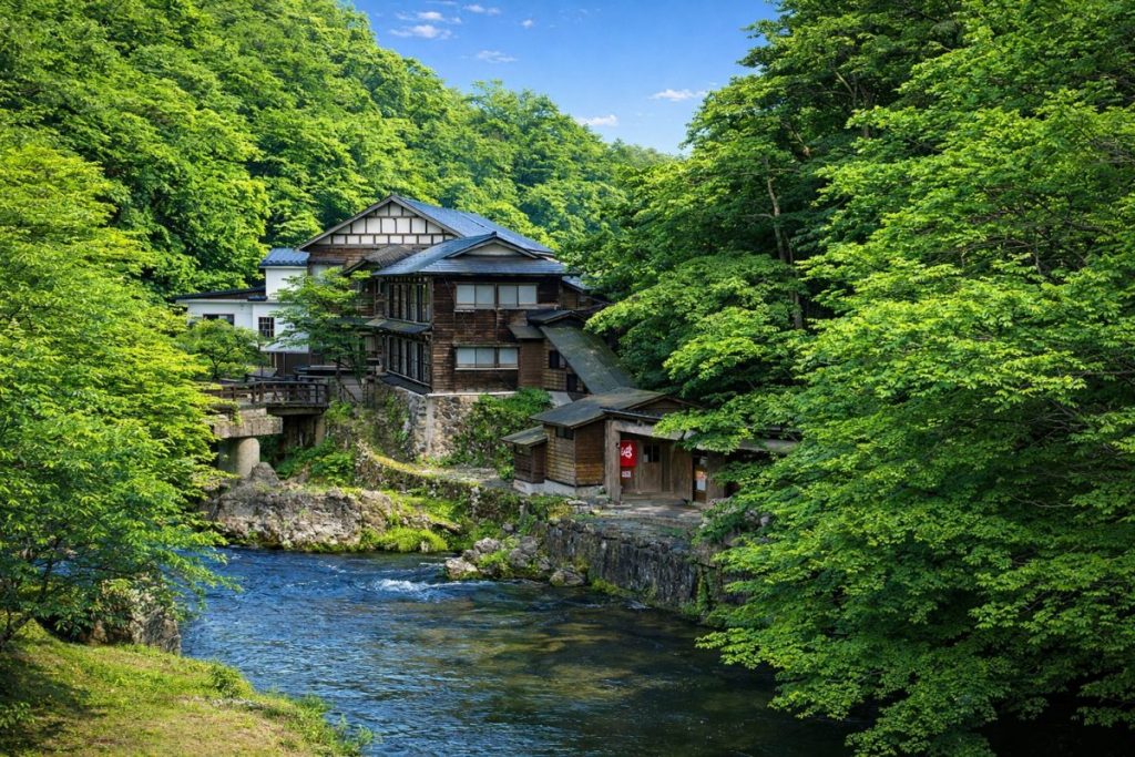
Taro Seawall - Niisato and Kawai Areas:Mountainous inland regions where forestry, agriculture, and traditional rural culture remain prominent.
Access
-
Railway:
JR Yamada Line: Miyako Station – Morioka Station
Sanriku Railway Rias Line: Kuji Station – Miyako Station – Sakari Station - Road: Sanriku Coastal Road, National Route 106
- Bus:Express and highway bus services connect Miyako with Morioka and Sendai.
Tourist Attractions
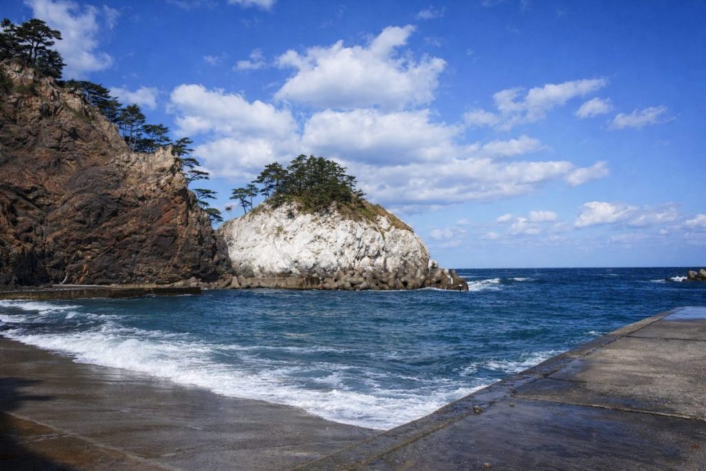
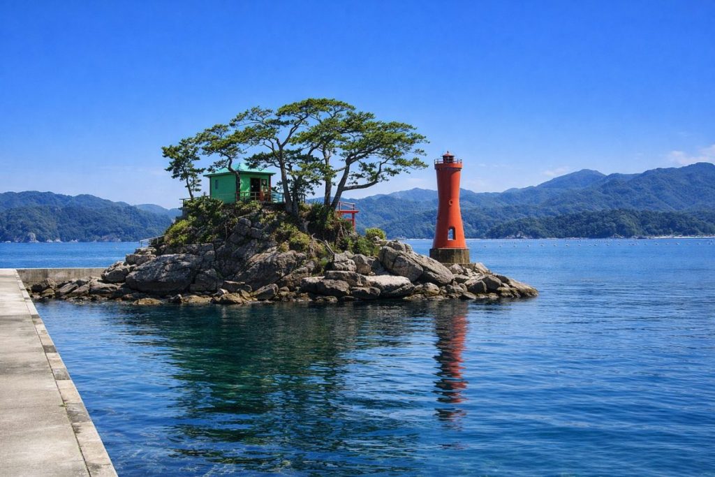
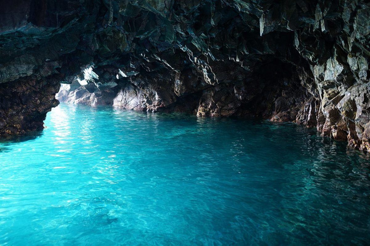
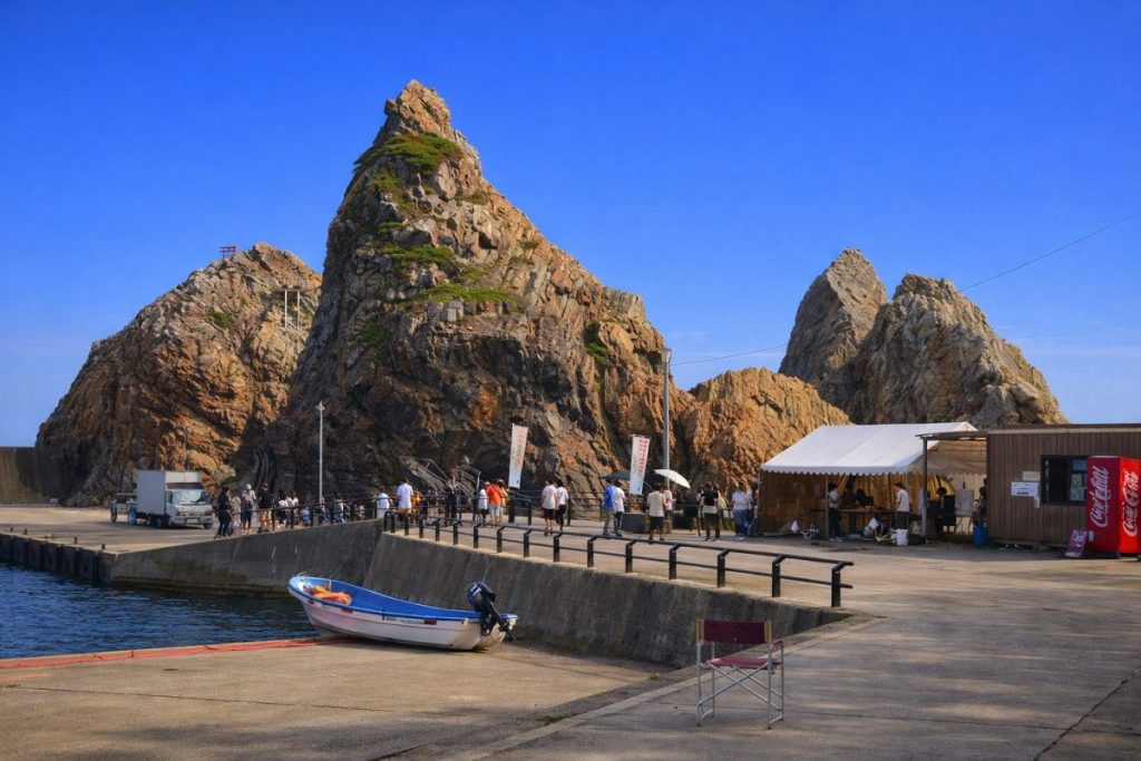
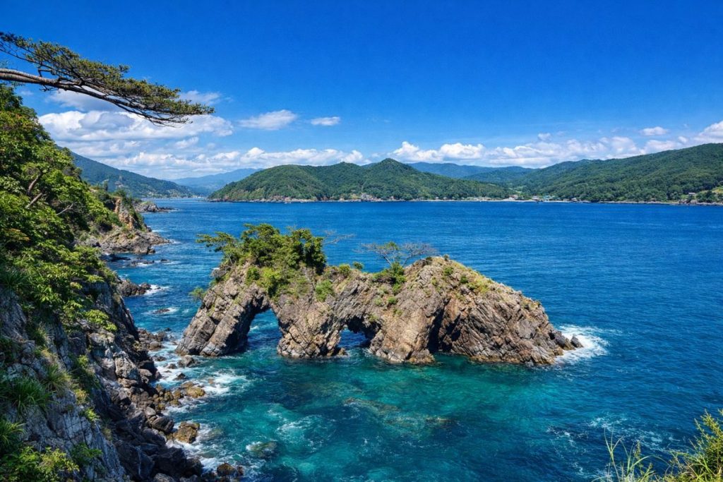
- Jodogahama Beach — One of the most scenic spots along the Sanriku Coast.
- Todogasaki Lighthouse — The easternmost lighthouse on Honshu.
- Iwate Prefectural Fisheries Science Museum — A facility showcasing marine science and fishing culture.
Related Links
Iwate Major Cities
This section presents a list of major cities in Iwate Prefecture.
You can access the hub page that consolidates information on Iwate Prefecture’s major cities via the button below.
-

Which Prefecture Is Ninohe City In? [Answer] Iwate Prefecture | Complete Guide to Ninohe City (Sightseeing, Culture, Local Products & Access)
-
Which Prefecture Is Kuji City In? [Answer] Iwate Prefecture | Complete Guide to Kuji City (Sightseeing, Culture, Local Products & Access)
-
Which Prefecture Is Ofunato City In? [Answer] Iwate Prefecture | Complete Guide to Ofunato City (Sightseeing, Culture, Local Products & Access)
-
Which Prefecture Is Miyako City In? [Answer] Iwate Prefecture | Complete Guide to Miyako City (Sightseeing, Culture, Local Products & Access)
-
Which Prefecture Is Kamaishi City In? [Answer] Iwate Prefecture | Complete Guide to Kamaishi City (Sightseeing, Culture, Local Products & Access)
-
Which Prefecture Is Kitakami City In? [Answer] Iwate Prefecture | Complete Guide to Kitakami City (Sightseeing, Culture, Local Products & Access)
-
Which Prefecture Is Hanamaki City In? [Answer] Iwate Prefecture | Complete Guide to Hanamaki City (Sightseeing, Culture, Local Products & Access)
-
Which Prefecture Is Ichinoseki City In? [Answer] Iwate Prefecture | Complete Guide to Ichinoseki City (Sightseeing, Culture, Local Products & Access)
-
Which Prefecture Is Oshu City In? [Answer] Iwate Prefecture | Complete Guide to Oshu City (Sightseeing, Culture, Local Products & Access)
-
Which Prefecture Is Morioka City In? [Answer] Iwate Prefecture | Complete Guide to Morioka City (Sightseeing, Culture, Local Products & Access)
Coastal Regional Development Bureau
This section presents the municipalities within the Coastal Regional Development Bureau area of Iwate Prefecture.
You can access the hub page that consolidates information on these municipalities via the button below.
-
Which Prefecture Is Fudai Village In? [Answer] Iwate Prefecture | Complete Guide to Fudai Village (Sightseeing, Culture, Local Products & Access)
-
Which Prefecture Is Tanohata Village In? [Answer] Iwate Prefecture | Complete Guide to Tanohata Village (Sightseeing, Culture, Local Products & Access)
-
Which Prefecture Is Iwaizumi Town In? [Answer] Iwate Prefecture | Complete Guide to Iwaizumi Town (Sightseeing, Culture, Local Products & Access)
-
Which Prefecture Is Yamada Town In? [Answer] Iwate Prefecture | Complete Guide to Yamada Town (Sightseeing, Culture, Local Products & Access)
-
Which Prefecture Is Otsuchi Town In? [Answer] Iwate Prefecture | Complete Guide to Otsuchi Town (Sightseeing, Culture, Local Products & Access)
-
Which Prefecture Is Rikuzentakata City In? [Answer] Iwate Prefecture | Complete Guide to Rikuzentakata City (Sightseeing, Culture, Local Products & Access)
-
Which Prefecture Is Ofunato City In? [Answer] Iwate Prefecture | Complete Guide to Ofunato City (Sightseeing, Culture, Local Products & Access)
-
Which Prefecture Is Miyako City In? [Answer] Iwate Prefecture | Complete Guide to Miyako City (Sightseeing, Culture, Local Products & Access)
-
Which Prefecture Is Kamaishi City In? [Answer] Iwate Prefecture | Complete Guide to Kamaishi City (Sightseeing, Culture, Local Products & Access)