| population | 16,386 peoples |
|---|---|
| area | 231.94 km² |
| population density | 70.6 peoples/km² |
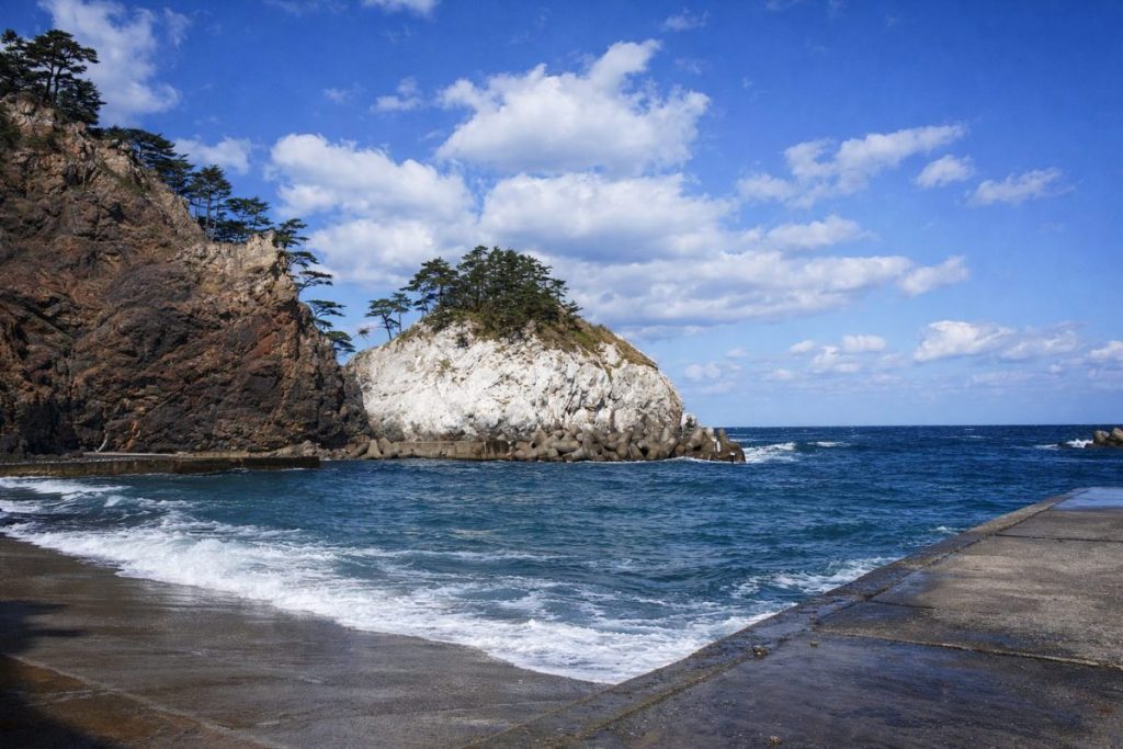
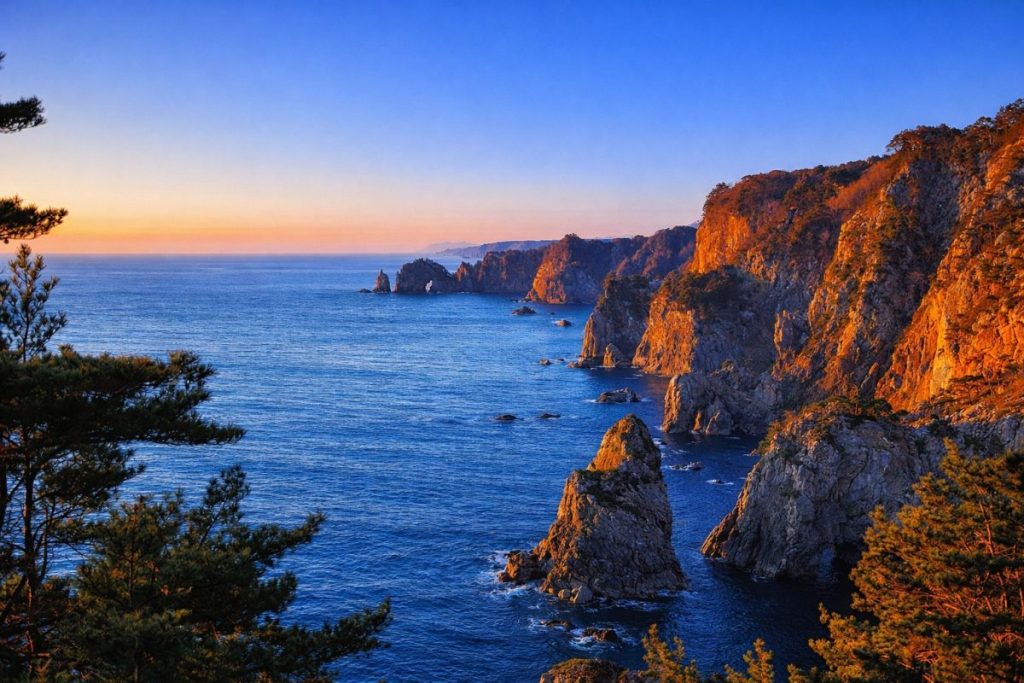
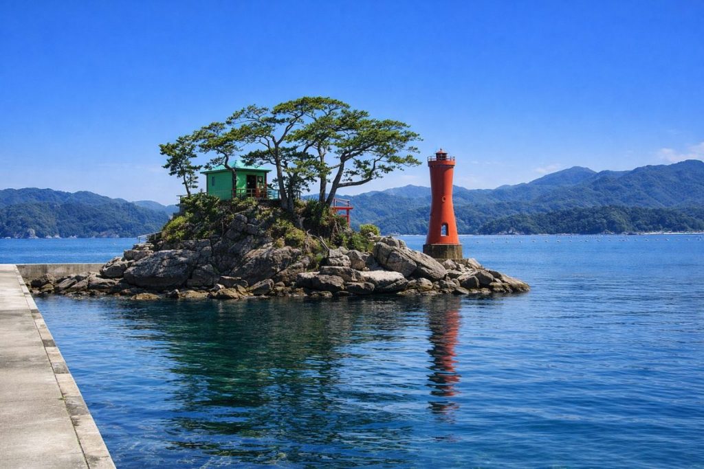
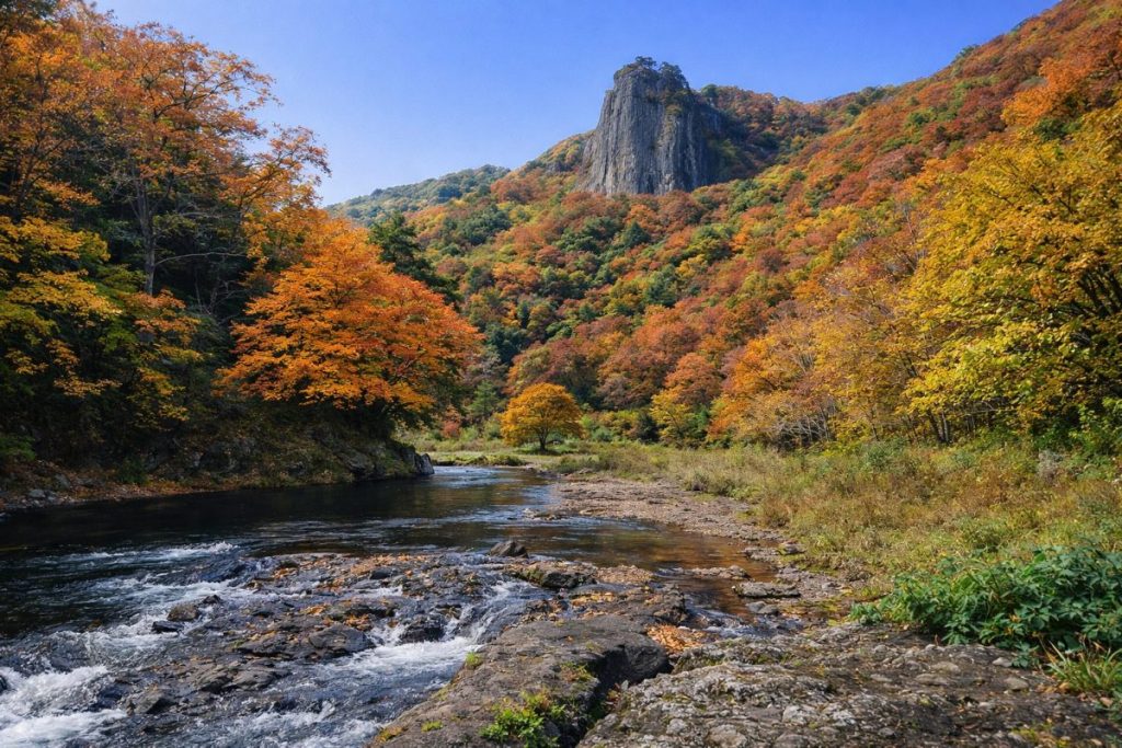
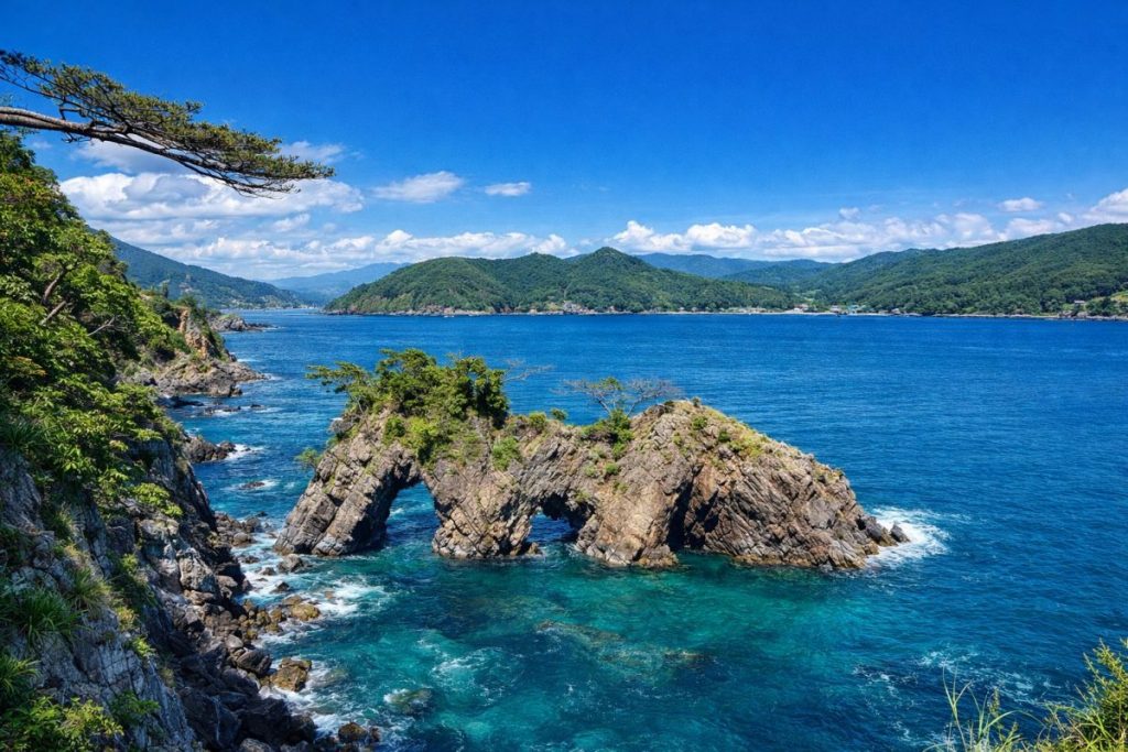
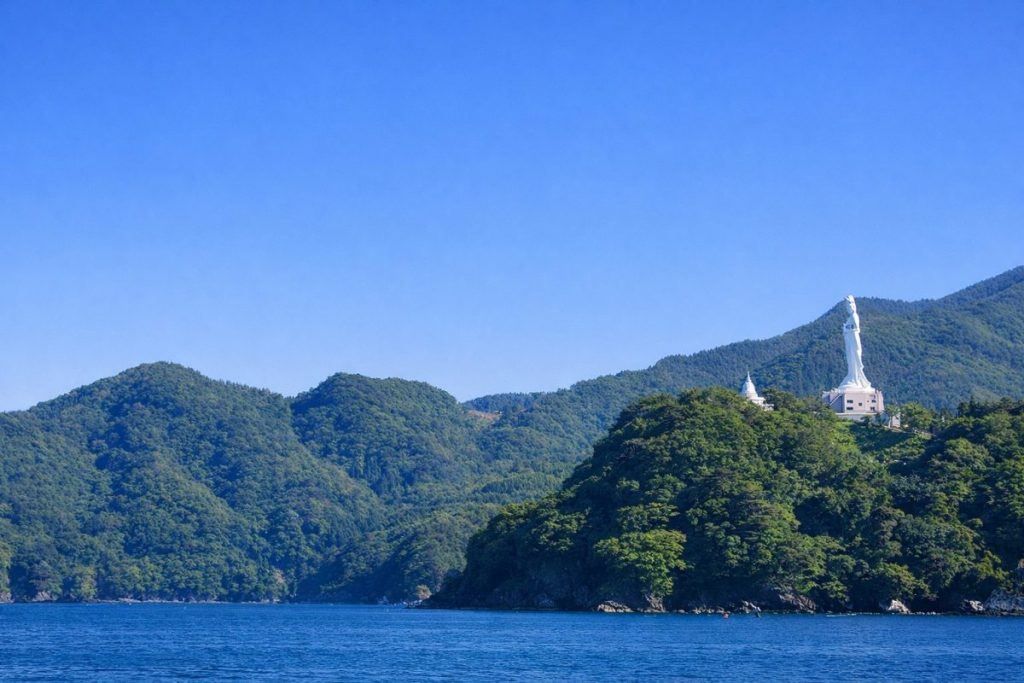
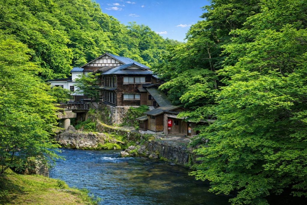
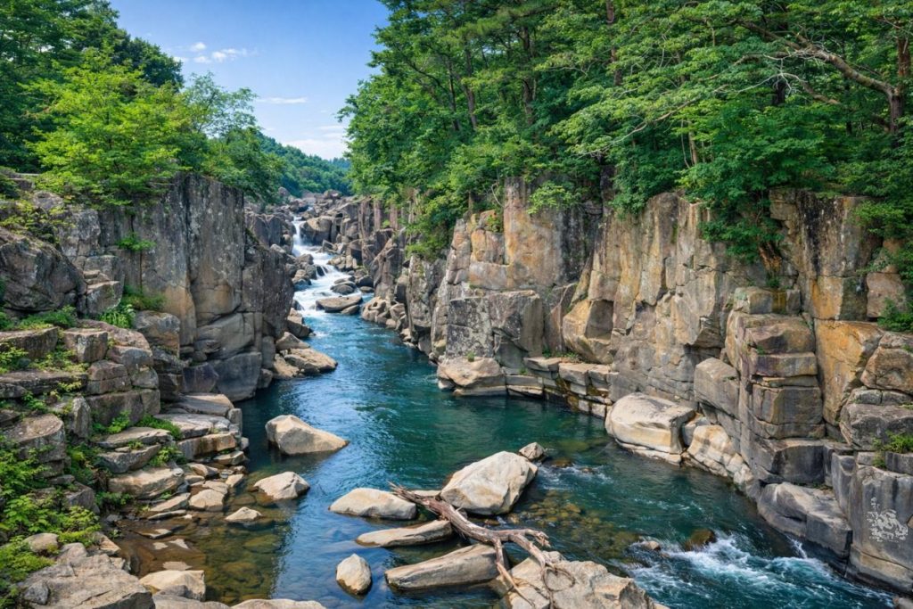
Rikuzentakata City is located in the southeastern part of Iwate Prefecture, facing the Pacific Ocean along the Sanriku Coast. It is one of the core coastal cities in southern Iwate, bordered by Ofunato City to the north, Sumita Town to the west, and Kesennuma City in Miyagi Prefecture to the south. Historically, the area developed as a key hub for administration, fisheries, and logistics along the Sanriku coastline. The urban area is situated on a plain at the innermost part of Hirota Bay, backed by mountainous terrain including Mount Hikami, creating a distinctive landscape where sea, river, and mountains coexist in close proximity.
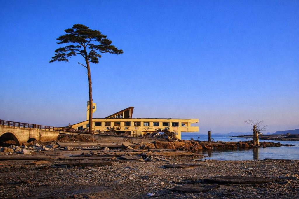
In March 2011, Rikuzentakata suffered catastrophic damage from the Great East Japan Earthquake and subsequent tsunami, which devastated much of the city center. Since then, extensive reconstruction projects have been undertaken, emphasizing disaster prevention and mitigation. Through land elevation, relocation to higher ground, and the development of the Sanriku Coastal Road, the city has been rebuilding itself as a safer and more resilient community while restoring daily life and economic activity.
History
The area now known as Rikuzentakata City was historically part of Kesen District in the former Mutsu (Rikuzen) Province. From ancient times, it functioned as an important coastal settlement supporting fisheries and trade between inland and maritime regions. During the Edo period, the area was governed by the Nanbu Domain, and communities developed based on fishing, agriculture, and coastal transportation. Following the implementation of the modern municipal system in the Meiji era, towns and villages such as Takata and Kesen were established, marking the beginning of regional modernization.
On January 1, 1955, eight municipalities—Kesen Town, Takata Town, Hirota Town, Otomo Village, Takekoma Village, Yahagi Village, Yokota Village, and Yonesaki Village—merged to form Rikuzentakata City. Over the following decades, the city grew into a central coastal municipality. The events of 2011 marked a profound turning point in its history, leading to large-scale urban restructuring and long-term recovery efforts that continue to shape the city today.
Culture and Traditions
Rikuzentakata has long nurtured a culture closely tied to the sea, characteristic of the Sanriku region. One of the city’s most symbolic cultural landscapes is Takata Matsubara, a coastal pine grove historically renowned for its scenic beauty. After the 2011 tsunami, the area was redeveloped as a memorial and disaster prevention park, serving both as a place of remembrance and a center for disaster education.
Traditional festivals such as the “Ugoku Tanabata Festival” and the “Kenka Tanabata Festival” continue to be held, preserving local customs and strengthening community bonds. Featuring elaborately decorated floats and traditional music, these events reflect the unique cultural heritage of the Kesen region. Even after the disaster, these traditions remain a vital source of pride and identity for local residents.
Local Products
-
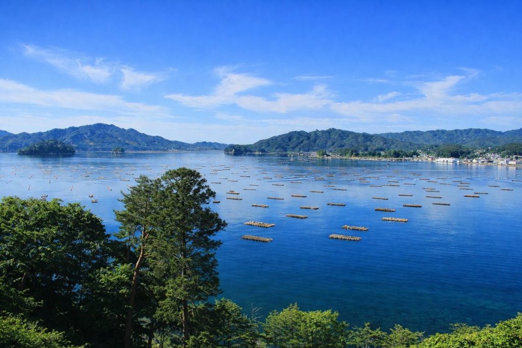
Oysters and Scallops from Hirota Bay:
Hirota Bay is known for its calm waters and rich nutrients, making it an ideal environment for aquaculture. Oysters and scallops produced here are highly regarded for their quality and flavor.
Hirota Bay (Google Maps) -
Wakame Seaweed and Kelp:
Seaweed cultivation is a major industry along the Sanriku Coast. Wakame and kelp from Rikuzentakata are valued for their thickness, texture, and rich taste.
Fishing Ports in Rikuzentakata -
Yonesaki Apples:
Apple cultivation is relatively rare in coastal areas, but Yonesaki apples thrive in the cool climate of Rikuzentakata. They are known for their balanced sweetness and acidity.
Yonesaki Area -
Brand Rice “Takata no Yume”:
Developed as a symbol of recovery, this locally branded rice is appreciated for its glossy appearance and well-balanced flavor.
Rice Fields in Rikuzentakata -
Processed Marine and Agricultural Products:
A variety of locally produced processed foods made from seafood and agricultural products are sold at roadside stations and local markets, popular as souvenirs.
Roadside Station Takata Matsubara
Living and Relocation Information
- Daily Convenience:Commercial facilities, medical institutions, and administrative offices are concentrated in the redeveloped city center, providing a convenient living environment.
- Child-Rearing Environment:Schools and childcare facilities have been rebuilt, with an emphasis on disaster education and experiential learning in nature.
- Medical Care:Healthcare services are centered around Iwate Prefectural Takata Hospital.
- Housing:Residential areas have been developed mainly on elevated land, prioritizing safety and disaster resilience.
- Lifestyle Features:Residents enjoy a calm lifestyle surrounded by both ocean and mountains, typical of a regional coastal city.
Climate and Living Environment
- Pacific coastal climate with relatively cool summers.
- Winters are cold but generally have limited snowfall.
- Sea fog may occur during certain seasons.
- Urban planning emphasizes disaster preparedness and safety.
Regional Characteristics (by Area)
- Takata Area:The administrative and commercial center, home to Rikuzentakata City Hall.
- Hirota Area:A coastal fishing community facing Hirota Bay, known for scenic views.
- Yonesaki Area:An agricultural area noted for apple cultivation.
- Kesen Area:A historically significant inland area with long-established settlements.
Access
- Rail / BRT: JR Ofunato Line BRT – Rikuzentakata Station
- Roads: Sanriku Coastal Road (Rikuzentakata IC), National Route 45
- Buses:Operated by Iwate Kotsu and JR Bus Tohoku.
Tourist Attractions
- The Miracle Pine Tree — A symbolic monument conveying the memory of the disaster.
- Takata Matsubara Tsunami Memorial Park
- Iwate Tsunami Memorial Museum
Related Links
Iwate Major Cities
This section presents a list of major cities in Iwate Prefecture.
You can access the hub page that consolidates information on Iwate Prefecture’s major cities via the button below.
-

Which Prefecture Is Ninohe City In? [Answer] Iwate Prefecture | Complete Guide to Ninohe City (Sightseeing, Culture, Local Products & Access)
-
Which Prefecture Is Kuji City In? [Answer] Iwate Prefecture | Complete Guide to Kuji City (Sightseeing, Culture, Local Products & Access)
-
Which Prefecture Is Ofunato City In? [Answer] Iwate Prefecture | Complete Guide to Ofunato City (Sightseeing, Culture, Local Products & Access)
-
Which Prefecture Is Miyako City In? [Answer] Iwate Prefecture | Complete Guide to Miyako City (Sightseeing, Culture, Local Products & Access)
-
Which Prefecture Is Kamaishi City In? [Answer] Iwate Prefecture | Complete Guide to Kamaishi City (Sightseeing, Culture, Local Products & Access)
-
Which Prefecture Is Kitakami City In? [Answer] Iwate Prefecture | Complete Guide to Kitakami City (Sightseeing, Culture, Local Products & Access)
-
Which Prefecture Is Hanamaki City In? [Answer] Iwate Prefecture | Complete Guide to Hanamaki City (Sightseeing, Culture, Local Products & Access)
-
Which Prefecture Is Ichinoseki City In? [Answer] Iwate Prefecture | Complete Guide to Ichinoseki City (Sightseeing, Culture, Local Products & Access)
-
Which Prefecture Is Oshu City In? [Answer] Iwate Prefecture | Complete Guide to Oshu City (Sightseeing, Culture, Local Products & Access)
-
Which Prefecture Is Morioka City In? [Answer] Iwate Prefecture | Complete Guide to Morioka City (Sightseeing, Culture, Local Products & Access)
Coastal Regional Development Bureau
This section presents the municipalities within the Coastal Regional Development Bureau area of Iwate Prefecture.
You can access the hub page that consolidates information on these municipalities via the button below.
-
Which Prefecture Is Fudai Village In? [Answer] Iwate Prefecture | Complete Guide to Fudai Village (Sightseeing, Culture, Local Products & Access)
-
Which Prefecture Is Tanohata Village In? [Answer] Iwate Prefecture | Complete Guide to Tanohata Village (Sightseeing, Culture, Local Products & Access)
-
Which Prefecture Is Iwaizumi Town In? [Answer] Iwate Prefecture | Complete Guide to Iwaizumi Town (Sightseeing, Culture, Local Products & Access)
-
Which Prefecture Is Yamada Town In? [Answer] Iwate Prefecture | Complete Guide to Yamada Town (Sightseeing, Culture, Local Products & Access)
-
Which Prefecture Is Otsuchi Town In? [Answer] Iwate Prefecture | Complete Guide to Otsuchi Town (Sightseeing, Culture, Local Products & Access)
-
Which Prefecture Is Rikuzentakata City In? [Answer] Iwate Prefecture | Complete Guide to Rikuzentakata City (Sightseeing, Culture, Local Products & Access)
-
Which Prefecture Is Ofunato City In? [Answer] Iwate Prefecture | Complete Guide to Ofunato City (Sightseeing, Culture, Local Products & Access)
-
Which Prefecture Is Miyako City In? [Answer] Iwate Prefecture | Complete Guide to Miyako City (Sightseeing, Culture, Local Products & Access)
-
Which Prefecture Is Kamaishi City In? [Answer] Iwate Prefecture | Complete Guide to Kamaishi City (Sightseeing, Culture, Local Products & Access)